PDF Walking Map with restaurants in the city on Google Map, PDF Tourism Brochure and model sightseeing courses is available.


PDF version of walking map with the courses recommended by the Tourist Agency.
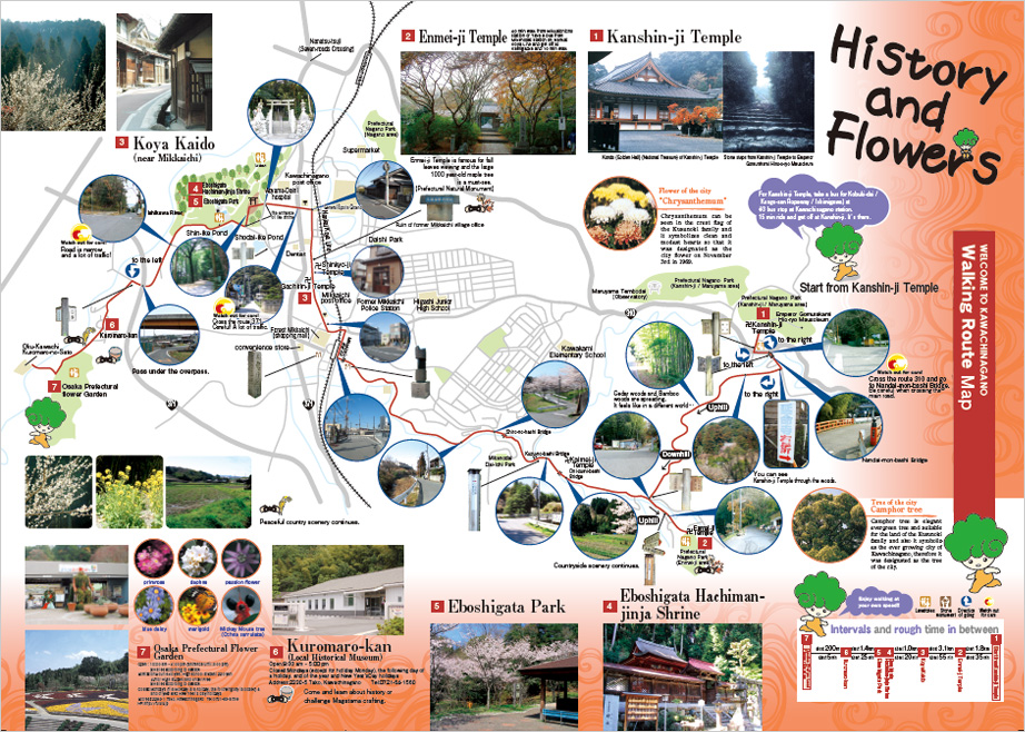
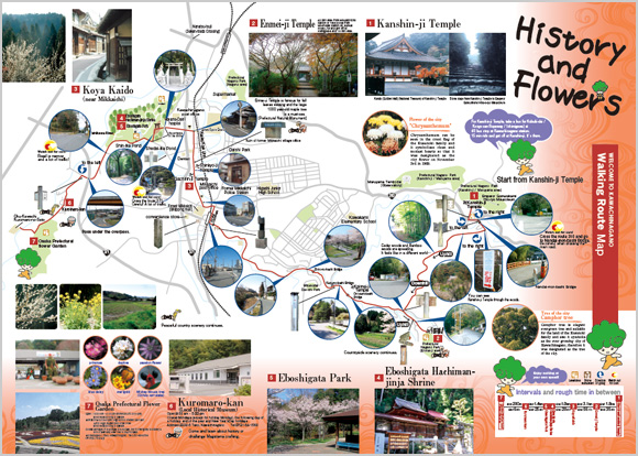
History and Flower Course
The length of the course: about 7.5 km. Kanshin-ji temple – Enmei-ji temple – Koya Highway – Eboshigaka-Hachiman-jinja shrine – Eboshigata-koen park – Furusato Rekishi Gakusyukan (Local History Museum) – Hanano-Bunkaen Botanical Garden
It’s a course to walk and learn about history of Kawachinagano and fully enjoy the nature.
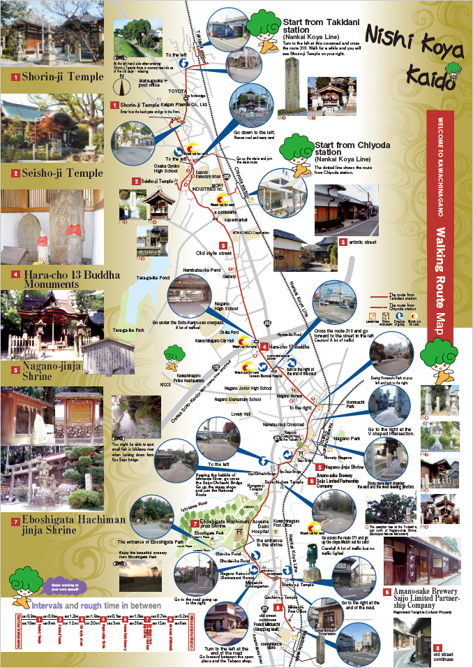
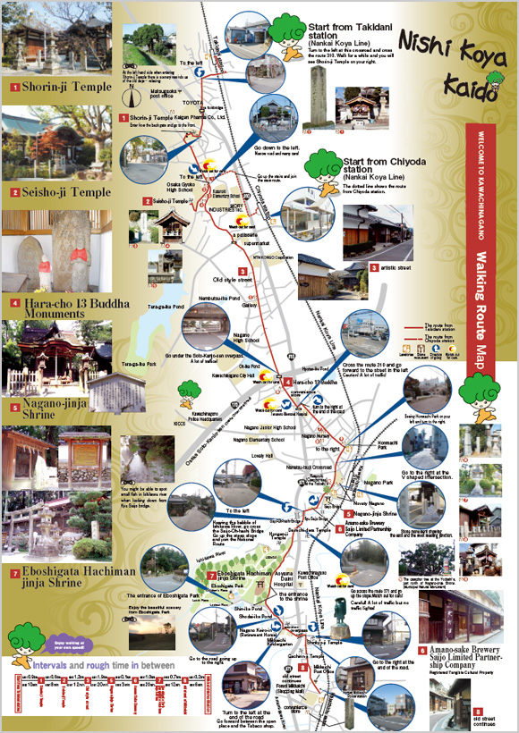
Nishi-Koya-Kaido Course
The length of the course: about 6.6 km. Takidani station on Nankai Koya Line – Shorin-ji temple – Seisho-ji temple – Historic street at Ishizaka – Nagano-jinja shrine – Amano-sake brewry, Saijo Limited Partnership Company – Eboshigata-Hachiman-jinja shrine – Eboshigata park – Histroric street in Mikkaichi – Mikkaichi-cho station on Nankai Koya Line
It’s a course you can explore Nishi Koya Kaido (West Koya Highway).
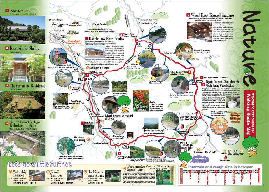
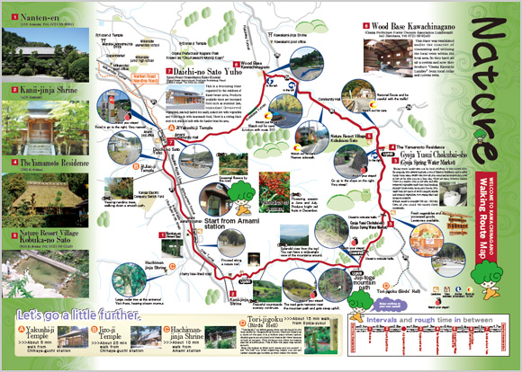
Yamabiko (Echo) Course
The length of the course: about 14.8 km. Amami station on Nankai Koya Line – Nanten-en – Kanii-jinja shrine – Juji-toge pass – Direct shop of Gyoja-yusui (natural spring water) – The Yamamoto Residence – Natural Resort Village Kobuka-no-sato – Wood Base Kawachinagano – Amami station on Nankai Koya Line.
It’s a course you can fully enjoy the nature of Kawachinagano.